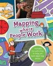
Full of hands-on activities to help you learn all about map skills whilst also learning about the features of where people work. This book will show you what a bird's-eye map is by looking at aerial photos; how landmarks can be shown as symbols; how to measure scale and distance; what map plans are; how compass points show you how to find directions; how to follow pathways and roads; how to use grid references; looking at landuse; and looking at transport maps. Illustrations by Sarah Horne in an amusing and lively style are combined with photographs to really capture a child's attention helping them to learn these important map skills.
This is Book 1 in the Mapping Series. See all Mapping books here.
No one has written a review for 'Mapping: Where People Work'
Why not be the first to share your opinion?
Dr Jen Green worked in publishing for 15 years and is now a full-time writer who has written over 200 books for children, on geography, the environment, history, natural history, and other subjects. Her Heinemann-Raintree title on Sustaining Our Natural Resources was selected in 2011 for the Junior Library Guild's SLJ Curriculum Levels program.
More about Jen Green