Collins Primary Atlas

by

Write a Review

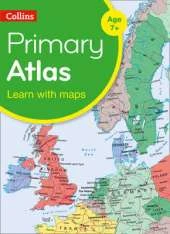
Bag the perfect KS2 Atlas this Back to School
A curriculum-supportive Primary Atlas for children aged 7-11 years (Key Stage 2). Designed for use in the classroom or at home, this revised edition includes informative politically coloured reference mapping of all major world regions and relevant topics.

  • This primary atlas provides an introduction to mapping of the UK, Europe and all major regions of the world. It includes information on map reading skills, the meaning of scale and measuring distances.
  • The reference maps are informative, politically coloured, and easy to read with national capitals and major cities easily identifiable. The maps are supported with national flags and basic national statistics.
  • Continental maps are linked to the regional mapping and are supported by a selection of aerial and terrestrial photographs. Continental relief maps show layer colouring and major physical features are highlighted.

Collins Primary Atlas Reviews | Toppsta

9780008319458

Share on

Videos

If you would like to provide a video review please sign up to our video panel.

Series

This is Book 14 in the Collins Primary Atlases Series. See all Collins Primary Atlases books here.

Category

See More Atlases & maps

See More Educational: Geography

Sign up to our newsletter for...

Free Book Giveaways, Recommendations & more

Be the first to write a Review


No one has written a review for 'Collins Primary Atlas'

Why not be the first to share your opinion?