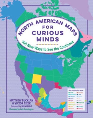
No matter how well you think you know North America, the 100 infographic maps in this singular atlas uncover a trove of fresh wonders that make the continent seem like the center of the universe. Did you know that North America is where the first T. rex was found? Or that it’s where you can visit the world’s biggest geode as well as its oldest, tallest, and largest trees—not to mention the world’s tallest and steepest roller coasters?! Brimming with fascinating insight (Who is the highest-paid public employee in each state?) and whimsical discovery (Where can you visit the world’s largest island in a lake on an island in a lake on an island?), this book highlights the unexpected contours of geography, history, nature, politics, and culture, revealing new ways to see North America—and the hundreds of millions who call it home.
This is Book 1 in the Maps for Curious Minds Series. See all Maps for Curious Minds books here.
See More Atlases & maps
No one has written a review for 'North American Maps for Curious Minds: 100 New Ways to See the Continent'
Why not be the first to share your opinion?
 The second book in a fabulous new magical, middle-grade series filled with adventure, wonder and wildness,