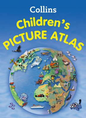
This highly illustrated picture atlas is designed to take children on a journey of discovery around the countries of the world. The mapping is clear, colourful and highly informative. Simple activities and quizzes encourage children to find out more about the mapped regions. Each spread includes introductory text about the region. Pictorial symbols are used on clear, colourful background mapping to depict themes such as national emblems, customs, food, birds, animals, buildings, sports etc. to help younger readers gain an understanding of peoples around the world. Continental spreads focus on flags and the most important geographical facts e.g. well known highest, lowest, largest physical and demographic features. Additional Features: * A variety of activity based features accompany the mapping on each spread designed to encourage the reader to extract information from the map. * Fascinating facts about each country -presented in a fun way for each spread * Website links are listed to assist further study for the older child.
See More Atlases & maps
No one has written a review for 'Collins Children's Picture Atlas'
Why not be the first to share your opinion?
Explore the world through accurate and up-to-date mapping.
More about Collins Maps