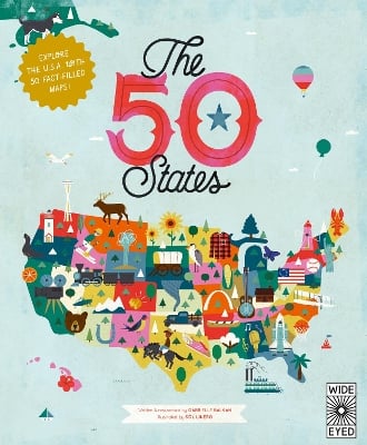
Explore every state of the USA from Alabama to Wyoming with these 51 charmingly illustrated infographic maps! Includes an expansive guide to the state flags and US presidents.
Discover more than 2,000 facts about the people, cities, nature and historic events that have helped make America what it is today. Ghost towns, swamp tours, the centre of the universe… bacon donuts, brainy berries, salmon jerky… The French Fry King, The Mother of Oregon, The Queen of Blues… be inspired by the inventiveness, beauty and diversity of the United States in this curious collection of fact-filled maps.
On each weird and wonderful map, find:
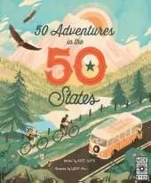
This is Book 11 in the Americana Series. See all Americana books here.
See More Picture books, activity books & early learning material
See More People & places
See More History & the past: general interest
See More Atlases & maps
No one has written a review for 'The 50 States: Explore the U.S.A. with 50 fact-filled maps!'
Why not be the first to share your opinion?
Illustrator SOL LINERO lives and works in Buenos Aires, Argentina. Her clients include Scholastic, Oprah magazine, Jamie Oliver Magazine and Wired.
More about Gabrielle BalkanSharyn Rosart has written and edited numerous books for children and grown-ups. She lives in Brooklyn, NY, with her family. She has visited 25 of the 50 states so far, and hopes to see the rest of them soon!
Illustrator SOL LINERO lives and works in Buenos Aires, Argentina. Her clients include Scholastic, Oprah magazine,
More about Sol Linero