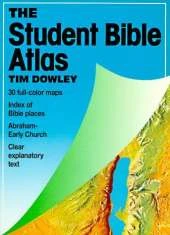
A completely new Bible Atlas for the Bible reader and student, with 79 full-colour, computer-generated original maps of Bible lands. The maps are carefully annotated to show the routes of the great travellers such as Abraham, Moses and Paul, major battles, migrations and invasions, and also feature explanatory captions detailing the significance of places flagged. Richly illustrated throughout with full-colour photographs, charts and diagrams, with text retelling clearly the story of God's people from the call of Abraham to the early spread of the Christian church. An invaluable resource for schools and Bible study.
See More Bibles & bible stories
No one has written a review for 'Candle Atlas of the Bible'
Why not be the first to share your opinion?
Dr Tim Dowley is a historian and a prolific author and editor of Bible resources for adults and children.
More about Tim DowleyJuliet David has written many children's stories and Bible activity books. Her other interests include painting, music, and travel to Israel and other Bible lands. This experienced author lives in London with her family. Gemma Denham studied art and design at Rawlins College before working as an illustrator. She loves illustrating children's books, helping t
More about Richard Scott