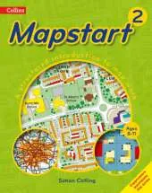
This structured map skills course uses a simple colourful layout to introduce young pupils to using and drawing maps and plans.
Mapstart 1 is a structured introduction to map work for 6-7 year olds. It assumes no previous experience of map skills and establishes a sound foundation for graphic concepts, skills and vocabulary at a very simple level.
Mapstart 1 has been designed with the following purposes in mind:
* to build children's spatial awareness through the use of familiar objects, toys, the locality of the school and space photos;
* to extend children's understanding and use of vocabulary associated with spatial location, organisation and movement;
* to provide continuity through the book by the use of vertical aerial photos;
* to introduce children to the perspective of plans and maps and to the representational characteristics of maps;
* to encourage children to observe features and relationships in oblique and vertical photos and maps;
* to foster children's appreciation of the Earth as a globe.
A free file of answers to questions in Mapstart 1 is available free to download at
http://resources.collins.co.uk/free/Mapstart1Answers.pdf
See More Educational: Geography
No one has written a review for 'Collins Mapstart 1'
Why not be the first to share your opinion?
Simon Catling taught in London primary schools before moving to Oxford Brookes University in the 1980s, serving as Dean and Assistant Dean in the 1990s and 2000s. He is a Past-President of the Geographical Association, author of Mapstart and Teaching Primary Geography (with Tessa Willy).
More about Simon Catling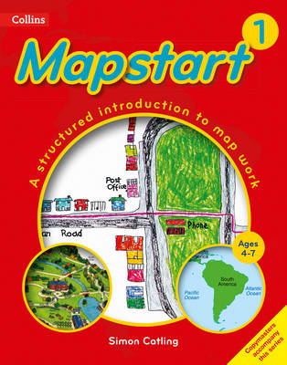
 The second book in a fabulous new magical, middle-grade series filled with adventure, wonder and wildness,


![Collins School Atlas: Collins School World Atlas [New Edition]](/images/covers/4/4/1/6/9780007484416-sm.webp?t=1776235218)